San Luis Potosí, Mexico — Nationwide coverage
GeoMap Platform

High-Precision
Geospatial Analysis for
Critical Industries

Photogrammetry, 2D/3D mapping, GeoMedia and interactive Cesium dashboards for energy, mining, security and infrastructure.

Aerial Services

Aerial Missions with
Drones and
Specialized Helicopters

LiDAR, photogrammetry, thermal and multispectral cameras. Inspection of power lines, pipelines, gas pipelines and public safety operations.

Software & Technology

IT Infrastructure,
Custom Software
and Equipment

Servers, NOC, CCTV, networks and web/mobile application development with geospatial intelligence and integrated APIs.

Geospatial Platform
LiDAR Photogrammetry
Security and Surveillance
NOC Infrastructure
Software Development
IT Equipment
GeoAI & Digital Twin
Business ERP
Aviation Systems
10+
Years of experience
About Aviation Systems

An integrated geospatial, aerial and IT technology platform

Aviation Systems (AVS) is a company specialized in developing intelligent geospatial platforms, integrating technology infrastructure and processing aerial and ground data.

We offer a complete hardware, software and services solution to transform the way organizations analyze, visualize and protect their environment.

Drones and sensors

Photogrammetry, LiDAR and thermography

Custom development

Node.js, React, Cesium, APIs

Recognized brands

Cisco, Fortinet, Hikvision, DJI

24/7 support

NOC and ongoing help desk

10+
Years of experience
10
Service lines
24
Business hours to answer your quote
15+
Recognized brands
6+
Industries served
Our services

Integrated solutions for every need

From aerial data capture to the software that turns it into strategic decisions

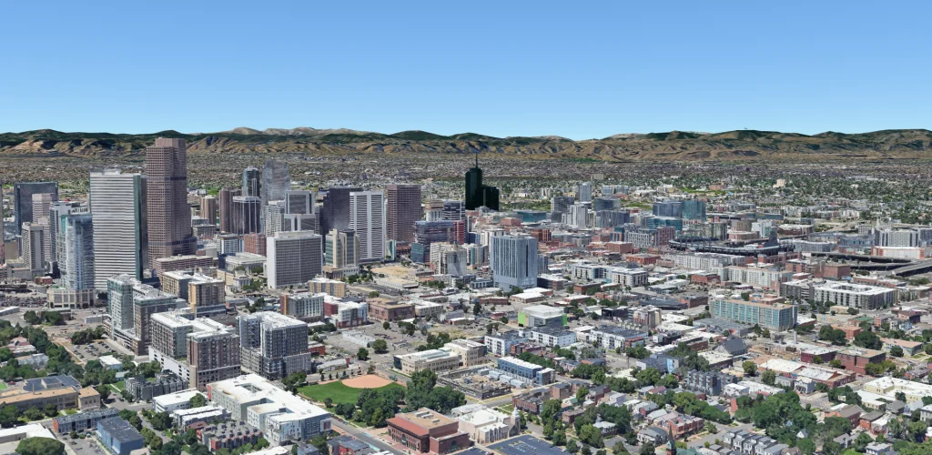
GeoMap Geospatial Platform
01 — Platform

GeoMap Geospatial Platform

A control center that brings aerial and ground data together in an interactive viewer. Live video on maps, reports and real-time decision-making.

2D/3D viewerReal timeMulti-layer
See more
GeoMedia — Georeferenced Video
02 — Video

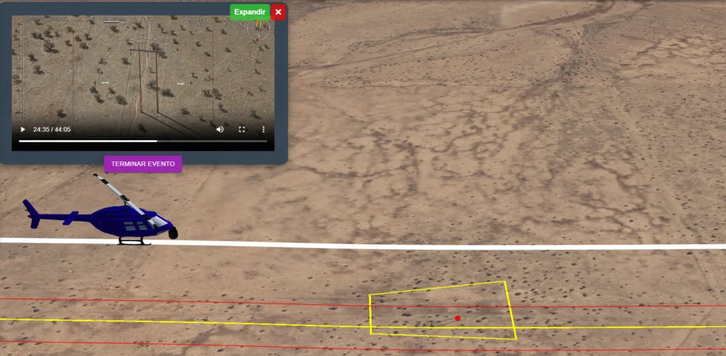
GeoMedia — Georeferenced Video

Live streams and recordings synchronized with the exact GPS location on the map. Ideal for NOCs, command centers and aerial surveillance.

GPS syncNOC readyHD streaming
See more
Photogrammetry and 2D/3D Mapping
03 — Photogrammetry

Photogrammetry and 2D/3D Mapping

Orthomosaics, point clouds and centimeter-accurate digital terrain models for construction, mining, surveying and environmental monitoring.

OrthomosaicsDTM/DSMcm accuracy
See more
01 — LiDAR

LiDAR and Aerial Data Processing

Advanced processing of LiDAR, photogrammetry, thermal and multispectral imagery with centimeter accuracy.

LIDARThermalMultispectral
See more
Infrastructure Inspection
02 — Inspection

Infrastructure Inspection

Aerial diagnosis of power lines, pipelines, gas pipelines and oil pipelines to detect anomalies and support predictive maintenance.

Power linesPipelinesPredictive
See more
Public Safety and Surveillance
03 — Security

Public Safety and Surveillance

Integration with public safety platforms. Search and rescue, perimeter surveillance and tactical operations.

DronesThermal cameraSAR
See more
NOC Operations Centers
01 — NOC

NOC Operations Centers

Design, installation and operation of command centers. 4K workstations, video walls, 24/7 monitoring and centralized management of geospatial operations.

4K multi-screenVideo wall24/7
See more
02 — Servers

Servers and Storage

Tower, rack and blade servers. NAS/SAN for large data volumes. Virtualization, high availability and automated backup.

NAS/SANVirtualizationRedundant
See more
03 — Networks

Networks, CCTV and Cybersecurity

Design and implementation with Cisco, Fortinet and MikroTik. IP CCTV with Hikvision and Dahua. Business firewalls and VPNs.

CiscoFortinetHikvision
See more
01 — Apps

Web and Mobile Applications

Custom development with Node.js, React and secure databases, focused on performance, security and scalability.

Node.jsReactAPIs
See more
02 — Dashboards

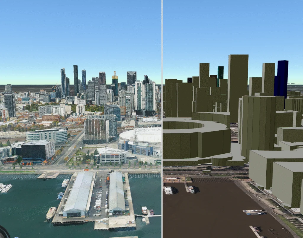
3D Dashboards with Cesium and React

Interactive 2D/3D visualizations of the territory with Cesium. Custom dashboards for geospatial analysis and executive reporting.

CesiumInteractive 3DReal-time KPIs
See more
03 — ERP

ERP — Resource Planning

A complete ERP system for purchasing, sales, inventory, finance, HR and fleet control. Phased implementation with training.

Multi-branchInventorySales
See more
01 — Drones

Professional Drones and Sensors

DJI drones with LiDAR sensors, RTK module, D-RTK and GNSS tripod. Accessories: batteries, charging stations, rugged tablets and hard cases.

DJILiDARRTK/DRTK
See more
02 — Computing

Computers and Workstations

PCs, laptops and workstations from Lenovo, ASUS, MSI and HP Enterprise. Custom configuration for CAD, simulation and geospatial analysis.

LenovoASUSHP Enterprise
See more
03 — Energy

Solar and Portable Power

Solar panels, MPPT controllers, hybrid inverters and GEL/lithium batteries. Portable generators and a trailer with a 7.5 m retractable mast for video surveillance.

SolarOff-gridPortable
See more
01 — GeoAI

GeoAI + Automatic Recognition

Intelligent detection of anomalies, structures and terrain changes using deep learning applied to aerial and satellite imagery.

Deep LearningAnomaliesAutomated
See more
Digital Twin Platforms
02 — Digital Twin

Digital Twin Platforms

Virtual replicas of the territory and infrastructure for simulations, behavior prediction and strategic preventive maintenance.

Interactive 3DSimulationsPredictive
See more
03 — GeoPaaS

GEO as a Platform (GeoPaaS)

Scalable cloud GIS service for international clients. GeoPaaS/GISaaS/DaaS with on-demand access and satellite monitoring.

Cloud GISSatelliteMultitemporal
See more
Brands we work with
CiscoFortinetHikvisionDahuaDJI EnterpriseSynologyHP EnterpriseMicrosoftASUSLenovoMikroTikPanduitRuijieMSIShot-OverCiscoFortinetHikvisionDahuaDJI EnterpriseSynologyHP EnterpriseMicrosoftASUSLenovoMikroTikPanduitRuijieMSIShot-Over
Applications

Solutions applied in the field

How we apply drones, geospatial platforms and infrastructure in Mexico's critical industries

3D mapping for volume control at a mining siteMining

3D mapping for volume control at a mining site

Photogrammetric survey with DJI Matrice to calculate stockpiles and support topographic control with centimeter accuracy.

Learn more
Public safety command center with GeoMediaPublic Safety

Public safety command center with GeoMedia

Integration of helicopter cameras with the GeoMedia platform for real-time supervision from a municipal NOC.

Learn more
Inspection of electric transmission linesEnergy

Inspection of electric transmission lines

Drone missions equipped with zoom and thermal cameras to detect anomalies on high-voltage towers.

Learn more
Blog and resources

Articles on geospatial
technology and drones

Specialized content for engineers, executives and professionals in critical industries (articles in Spanish)

What is drone photogrammetry and what is it used for in Mexico?Photogrammetry
Jun 2025·7 min

What is drone photogrammetry and what is it used for in Mexico?

Technique, accuracy and industrial applications of drones that generate 3D models.

Read more (Spanish)
Drones in mining: 5 applications already saving millionsMining
Jun 2025·9 min

Drones in mining: 5 applications already saving millions

Volume control, slopes, equipment inspection and perimeter security.

Read more (Spanish)
GeoMedia vs ArcGIS vs QGIS: which geospatial platform should you choose?GIS platforms
May 2025·11 min

GeoMedia vs ArcGIS vs QGIS: which geospatial platform should you choose?

A complete comparison: pricing, features and which industry each one suits.

Read more (Spanish)
Power line inspection with drones in Mexico: 2025 guideEnergy
May 2025·8 min

Power line inspection with drones in Mexico: 2025 guide

How thermal drones cut costs by up to 70% compared with ground inspection.

Read more (Spanish)
What is a NOC and why does your company need one to manage drones?NOC
Apr 2025·6 min

What is a NOC and why does your company need one to manage drones?

Operations centers centralize the management of fleets and geospatial data.

Read more (Spanish)
Drone regulation in Mexico 2025: complete AFAC guideRegulation
Apr 2025·10 min

Drone regulation in Mexico 2025: complete AFAC guide

Permits, restricted zones and how to operate professional drones legally.

Read more (Spanish)
What is an ERP and when does your company really need one?Software
Mar 2025·8 min

What is an ERP and when does your company really need one?

Signs that your operation needs an ERP system: inventory and rework.

Read more (Spanish)
GeoAI: how artificial intelligence is transforming geospatial analysisGeoAI
Mar 2025·12 min

GeoAI: how artificial intelligence is transforming geospatial analysis

Automatic anomaly detection with deep learning on aerial imagery.

Read more (Spanish)
Geospatial digital twin: what it is and how it benefits industryDigital Twin
Feb 2025·9 min

Geospatial digital twin: what it is and how it benefits industry

Virtual replicas of the territory to simulate scenarios and predict failures.

Read more (Spanish)
Geospatial analysis in public safety: how drones save livesPublic Safety
Feb 2025·7 min

Geospatial analysis in public safety: how drones save lives

Night surveillance, search and rescue with drones and geospatial analysis.

Read more (Spanish)

Ready to transform your operations with geospatial technology?

More than 10 years helping critical industries make better decisions.

Let's talk

Contact us to quote your project

Tell us what you need and our team will reply within 24 business hours.

Location
San Luis Potosí, Mexico
Operations nationwide

Send us a message

We reply within 24 business hours

I want to receive the answer by *

This request does not create a purchase order or reserve stock. We never ask for card details.

Looking for equipment or a solution for your business? I can help.